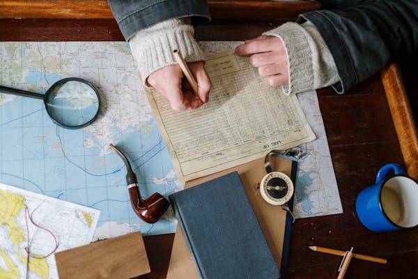
When you think about learning history, you probably imagine boring textbooks filled with dates you have to memorize, right? Maybe some black-and-white photos, some old paintings, and a few dusty timelines. But you know what almost nobody talks about enough? Maps.
Seriously, maps are like this hidden treasure when it comes to learning history. They’re not just about geography or memorizing where countries are on a globe. Maps can actually tell amazing stories — stories about people, wars, journeys, hopes, dreams, mistakes, and victories. Maps show you how the world has changed, how humans have moved, and how history isn’t just something that “happened” — it’s something that shaped everything around us.
Let’s talk about why maps are so important, and why every history lesson would be 10 times better if it included them.
1. Maps Show You How Wildly The World Has Changed
If you ever look at a really old map, it’s shocking how different the world looks.
Countries that don’t exist anymore, empires that stretched across half the planet, places that didn’t even have names yet — all of that shows up when you flip through history using maps.
Take the Roman Empire, for example. Reading a paragraph about it in a book is fine. But seeing a giant map showing how Rome controlled land from Britain to North Africa? That hits different. You suddenly realize, “Wow, this was massive!”
Maps help you see change instead of just reading about it. It makes it feel real.
2. Maps Are About People, Not Just Places
Here’s the thing: maps aren’t just about land. They’re about people.
When you track where people moved, where they fought wars, where they built cities, you’re actually following human stories.
Think about the Silk Road — a network of trade routes connecting China to Europe. It wasn’t just about silk. It was about traders, adventurers, and entire cultures mixing together.
Or think about how millions of people from Ireland fled to America during the Potato Famine. A map showing that mass migration makes it crystal clear how desperate those journeys were.
Maps tell human stories without even needing words.
3. Maps Make Complicated Stuff Easy To Understand
Some parts of history are confusing if you only use words.
Like, try explaining the Cold War without visuals: “Well, the world was divided into two ideologies…blah blah.”
yawn.
Now show a map with the NATO countries in blue and the Warsaw Pact in red? Suddenly you get it. There’s a clear line. There’s tension. You can see the standoff.
Maps take big, complicated ideas and make them simple enough for even a 10-year-old to get.
4. Old Maps Are Like Time Machines
One of the coolest things about studying old maps is that they show you how people saw the world back then.
- Medieval maps sometimes showed dragons or monsters lurking in unknown areas.
- Some maps had Jerusalem as the literal center of the Earth.
- Some explorers believed California was an island!
Looking at these maps is like peeking inside the minds of people who lived hundreds or even thousands of years ago. You realize that history isn’t just about what was true — it’s also about what people thought was true.
That’s pretty mind-blowing if you think about it.
5. Maps Teach You To Be A Critical Thinker
Not all maps tell the truth.
Some maps were made to make a country look bigger or more powerful. Some erased people who lived in a place long before colonizers arrived. Some twisted borders for political reasons.
When you study maps, you learn to ask important questions like:
- Who made this map?
- Why did they draw it this way?
- What story are they trying to tell?
Learning to question what you see is one of the most valuable skills you can have — in history class and in life.
6. Digital Maps Make It Even More Fun
Thanks to technology, maps aren’t just paper anymore.
Now you’ve got interactive maps where you can:
- Zoom in on ancient cities
- Watch borders change over centuries
- Follow soldiers moving during a war
Tools like Google Earth and museum websites let you jump into history in a way that feels more like an adventure game than a classroom lecture.
When students get to explore history by actually clicking around and discovering things themselves, they remember it way better. It’s like turning history into a real experience instead of just homework.
7. Easy Ways Teachers Can Use Maps To Make History Exciting
If you’re a teacher (or even just a curious parent), you don’t have to do anything fancy. There are lots of easy ways to bring maps into the mix:
- Create migration maps: Have students draw the journey of settlers, refugees, or explorers.
- Battle maps: Let students map out key battles from a war and see how the fighting shifted.
- Compare old and new maps: Show an ancient map and a modern one side by side. Ask: what changed? Why?
- Family history maps: Get students to map where their ancestors came from. It makes history personal and emotional.
These simple activities make history classes come alive.
8. Maps Help Build Empathy
It’s easy to read about sad events in history and not feel much. But when you see it on a map, it hits harder.
For example:
- Following the Trail of Tears on a map shows just how far Native Americans were forced to walk after being expelled from their lands.
- Looking at maps of the Atlantic slave trade shows the massive scale of human suffering.
Maps make you realize that history wasn’t just “something that happened.” It was millions of real people, facing real struggles, moving across real land.
That kind of realization builds empathy — and that’s something every student (and adult) needs.
9. Maps Help Us Remember
Have you ever noticed how certain places become part of our memory of an event?
- Normandy = D-Day.
- Gettysburg = the turning point of the Civil War.
- Hiroshima = the horrors of nuclear war.
Maps anchor history to places. They help us remember not just what happened, but where it happened. And when you remember a place, you’re more likely to remember the story tied to it.
That’s why so many memorials, museums, and monuments include maps. They make memory stick.
10. If You Love History, You Gotta Love Maps
Here’s the honest truth: if you really want to understand history, you can’t skip the maps.
Maps show you the big picture — literally.
They connect events to geography.
They show human movement, struggle, and triumph.
They make history real.
Without maps, history is just a bunch of random facts. With maps, history becomes a living, breathing story you can see unfolding.
If you want to be good at history — or just actually enjoy learning it — maps are your best friend.
Final Thoughts: Maps Are Magical
Maps are magic. Simple as that.
They turn boring facts into exciting stories.
They help you see, feel, and understand history in ways words alone never could.
They show you not just what happened — but how it shaped the world we live in today.
If you’re a student, a teacher, or just someone who loves learning, do yourself a favor: dive into some old maps. Explore migration patterns, ancient cities, battlefields, or trade routes.
You’ll be amazed at how much more real, emotional, and memorable history becomes when you can actually see it laid out before your eyes.
History isn’t just a list of dates. It’s a map of where we’ve been — and where we might be going next.
And it’s all right there, waiting for you.


